Though it sits on the western edge of North America, San Francisco had always looked eastward – to its bay, rather than the vast Pacific. Its magnificent protected harbor had driven the City’s economy, and its population, since the Gold Rush of 1849. Residential neighborhoods gradually fanned out from the downtown core in the decades that followed. With the jobs clustered around the waterfront, residential growth followed the early transit lines that connected homes to those jobs.
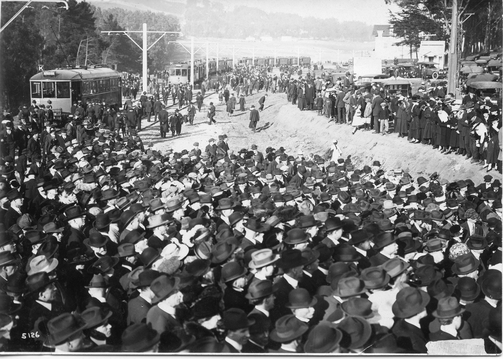
The opening of the Twin Peaks Tunnel February 3, 1918, brought mobs of San Franciscans way out west to St. Francis Circle, which was as far as the Muni K-line went then. (The crowd is listening to Mayor Rolph speak, out of frame to the right.) Soon, an agreement would be reached with United Railroads to extend the K over its Ocean Avenue tracks. SFMTA Archive
Improvements in transit technology helped. Horse-drawn streetcars were eclipsed by cable cars, twice as fast. By the end of the 1880s, cable cars ran from the Ferry Building halfway to the Pacific, even to the end of Market Street and then over the Castro hill into Noe Valley.
Then came the electric streetcar, twice as fast as the cables. By 1903, these high-technology vehicles ran all the way south to San Mateo, 20 miles from downtown. The 1906 earthquake and fire decimated most of the City’s remaining cable system along with much of its housing stock and business property. Still blessed by its harbor, the City quickly began rebuilding. But many San Franciscans had been forced to Oakland and other close-in East Bay cities by the shaking and flames. They found their new surroundings attractive, and fast and frequent ferry service coupled with streetcars and interurban trains that met the ferries on the Oakland side made their daily commute to the City faster than even some San Franciscans enjoyed—and at the same price: just a nickel!
Envisioning Speed
While the northeastern quarter of San Francisco was densely packed with residents by 1910, the western half of the city was still sparsely settled. Except for the Cliff House and Sutro Baths at Land’s End, the city’s seven-mile Pacific shoreline seemed deserted. An exception: a collection of discarded cable cars and horsecars festooned among the dunes along the beach south of Golden Gate Park. Pioneers turned them into modest homes and dubbed it Carville.
Streetcars had reached the beach by this time, but only where they could skirt the giant pair of hills that bisected the city – Twin Peaks. The 5 and 7 lines of United Railroads framed Golden Gate Park on Fulton Street and Lincoln Way, and the 12-line ran down Mission from the Ferry, then out Ocean Avenue and Sloat Boulevard to the ocean. But commuting from the ends of those lines, especially the 12, often took longer than taking a ferry from Oakland, where the weather was better anyway.
But what if you could go under Twin Peaks with fast streetcars? An area of 16 square miles would then be within reasonable commute distance of downtown.
The idea was attracting public debate at least as early as 1908, even before the bond issue that created Muni. When Muni opened its first lines, on Geary Street at the end of 1912, excitement about a Twin Peaks Tunnel grew, and the idea was at the core of a city transit plan prepared by famed consultant Bion J. Arnold in 1914 and strongly endorsed by Mayor “Sunny Jim” Rolph and powerful city engineer M.M. O’Shaughnessy. What cinched the tunnel was the willingness of large property owners who would be served by the tunnel to pay for it. It ended up costing $4 million.
While several locations were initially considered for the east portal of the tunnel, the obvious choice was the end of Market Street, a wide boulevard that already had streetcar service by United Railroads as far as Castro Street, where the ground started climbing up to Twin Peaks. The City paid for the tunnel by assessing property owners who wanted it and would benefit from it. That included those looking to develop residential neighborhoods that came to be known as Forest Hill, West Portal, and St. Francis Wood.
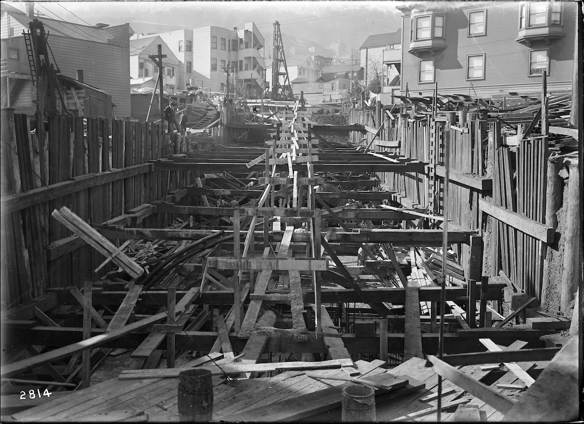
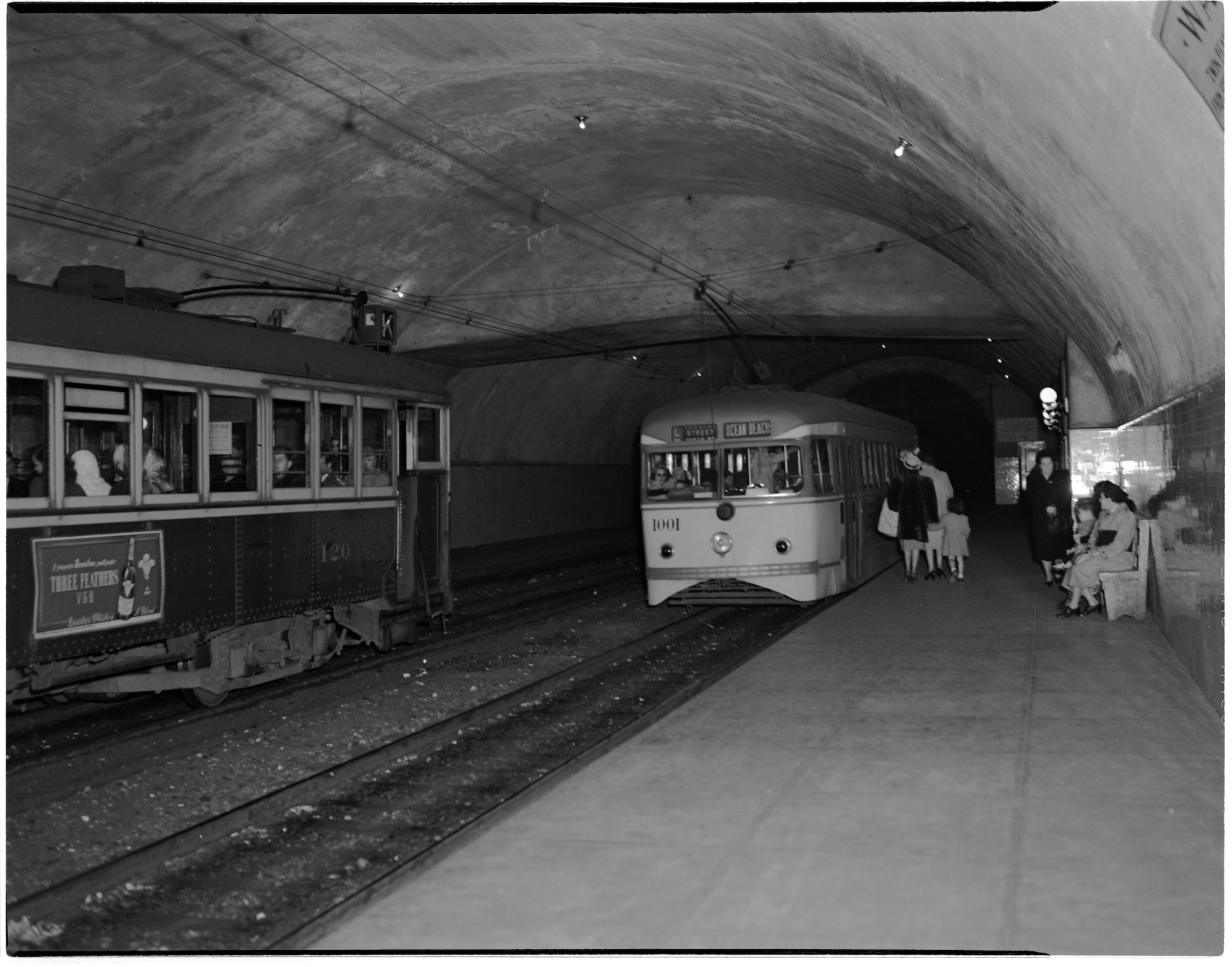
Construction on the tunnel started at the end of 1914, clawing through the very soft ground near Castro, which caused the eastern end of the tunnel to be built with a “cut-and-cover” method. A small station was built at Eureka Street, just inside the Castro portal, even though there was a surface stop at Castro. O’Shaughnessy wanted to make it easy to connect the tunnel to a future streetcar subway under Market Street, which he was confident would have to be built soon. As this part of the tunnel was completed, with each track in its own concrete box, new streets were created above, including an extension of Market Street and a short street, Storrie, which the tunnel’s contractor named after himself.
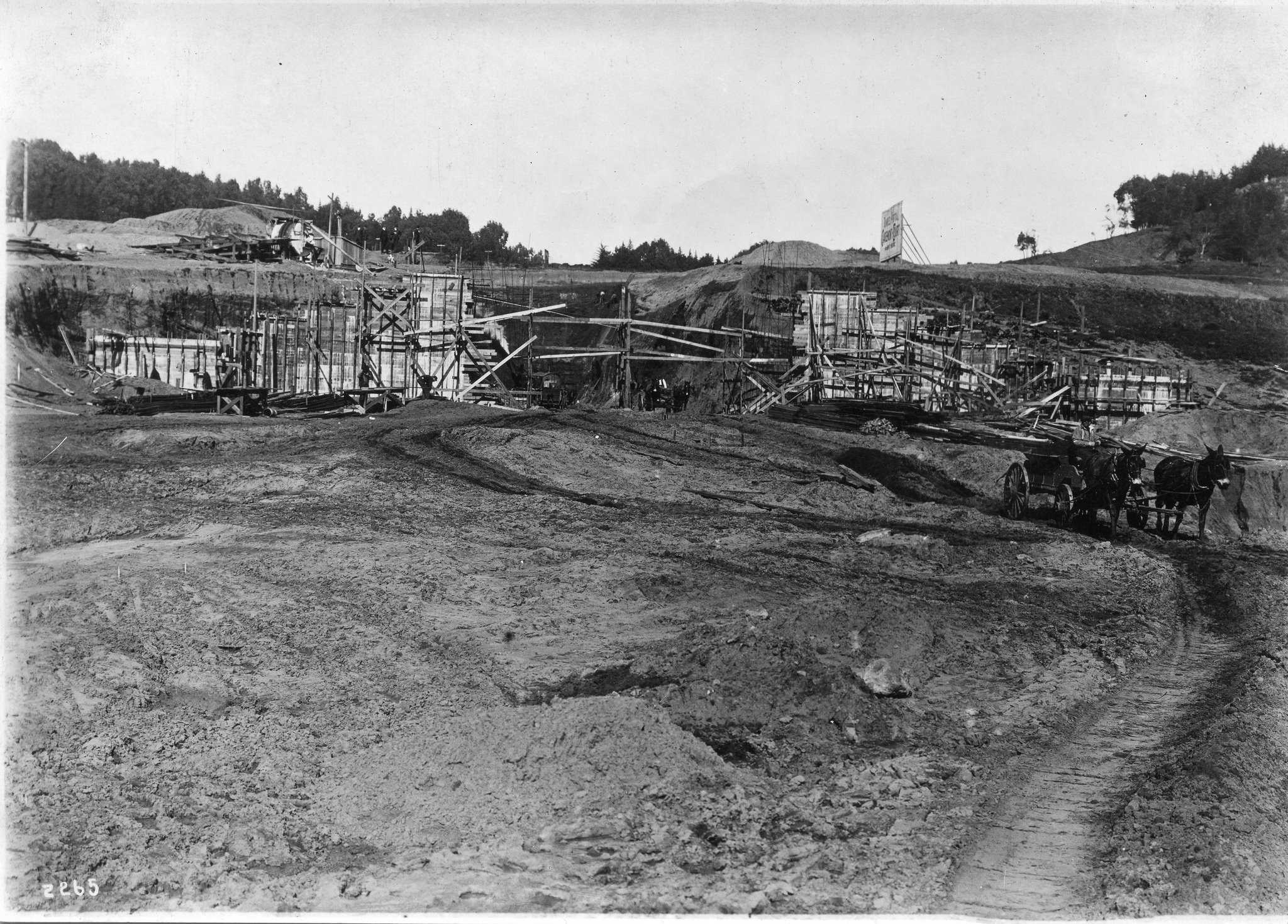

The bulk of the construction was deeper tunneling, with a single bore spanning both streetcar tracks. Just east of the tunnel’s midway point, a second station, named for the nearby lake, Laguna Honda, was installed at the deepest part of the tunnel. Elevators, manned by Muni operators, took riders to and from the platforms. Soon after the tunnel opened, a new neighborhood, Forest Hill, sprang up, and the station eventually took the neighborhood’s name.
The tunnel itself was completed in July 1917, though tracks and wires had not yet been installed. At a dedication ceremony on July 25, 1917, Mayor “Sunny Jim” Rolph rather grandiloquently stated, “Westward the course of Empire takes its way” (though streetcar service through the tunnel was still seven months away).
The Board of Supervisors fought about whether the private United Railroads, which already reached the West of Twin Peaks area by roundabout routes, would be allowed to share the tunnel with the Municipal Railway. Answer: no. Instead, Muni built its own set of tracks along Market Street from the Ferry to Castro Street, flanking the private company’s “inside tracks.” The sound of competing streetcars rumbling along Market side by side on the quartet of tracks became known as “the roar of the four”.
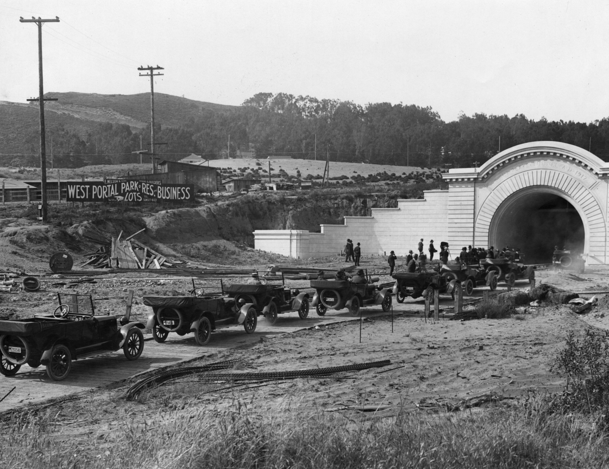
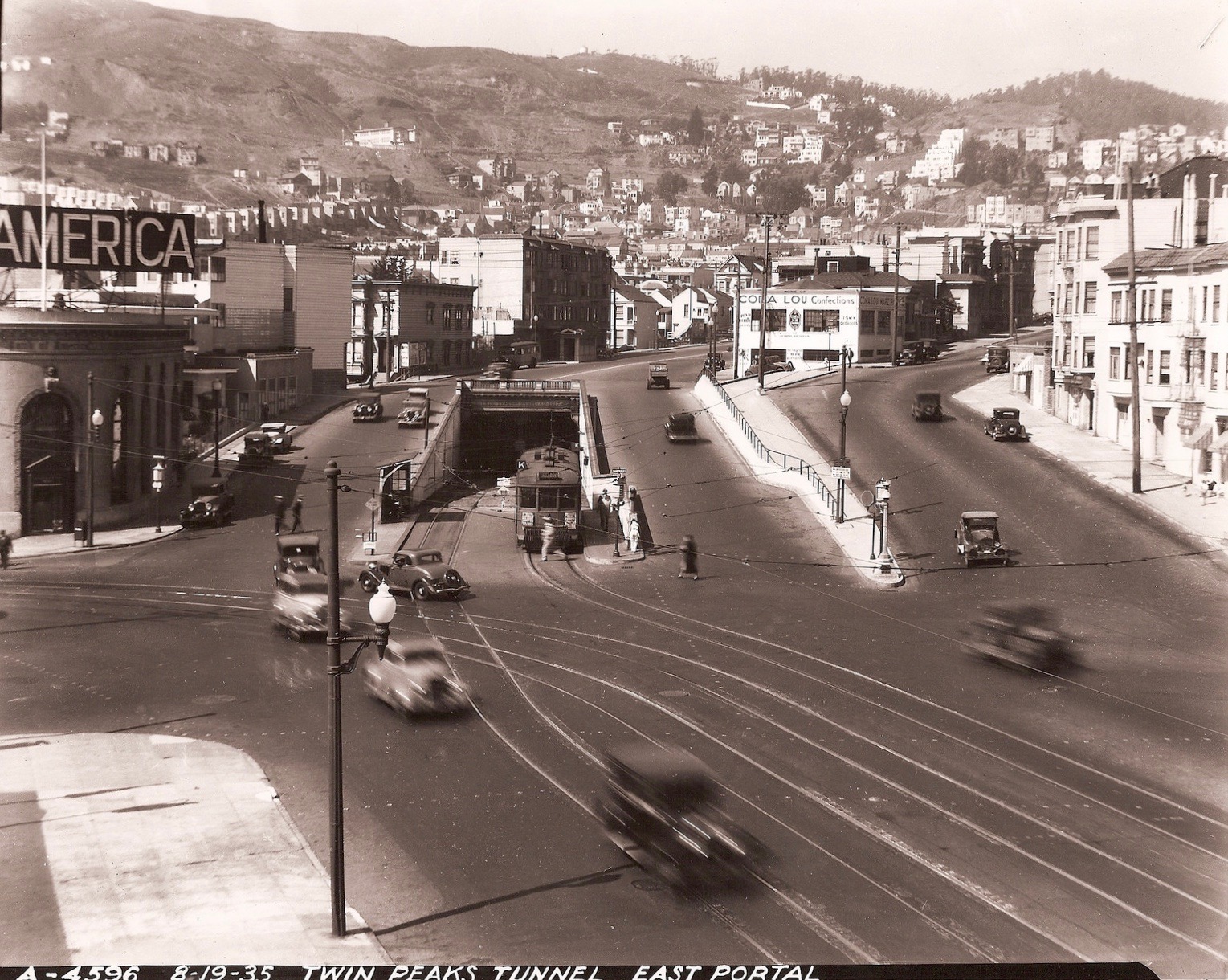
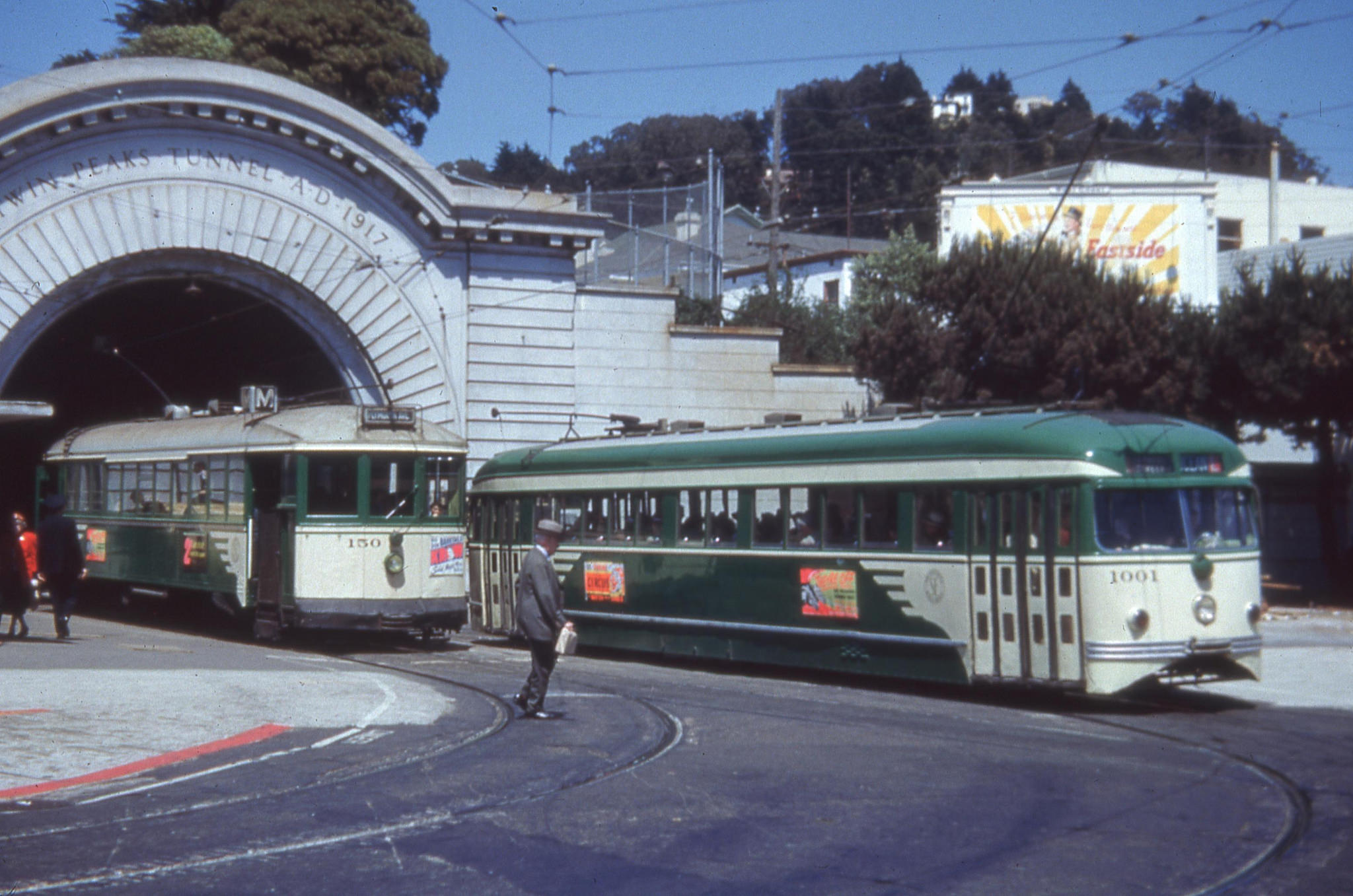
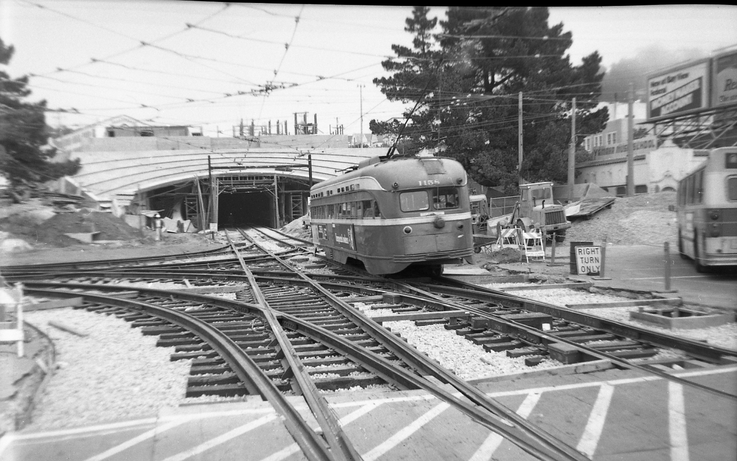
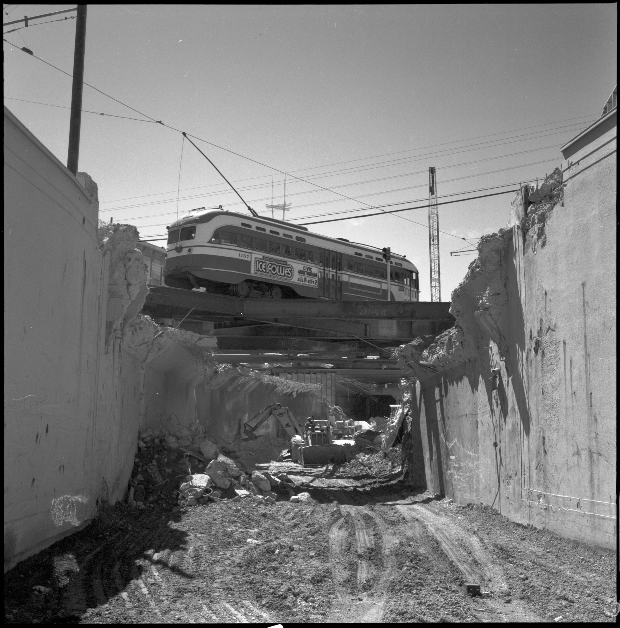
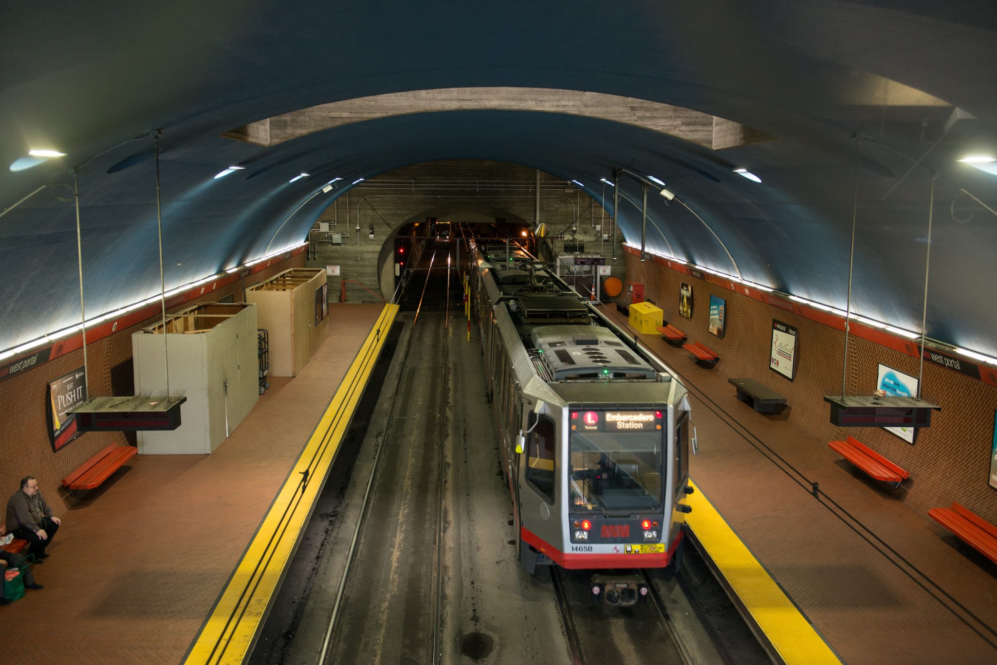
The 12,000-foot Twin Peaks Tunnel was the longest streetcar tunnel in North America until eclipsed in 1998 by the Robertson Tunnel in Portland. The original West Portal of the tunnel was monumental, dominating the new neighborhood shopping street named for it. That imposing façade was demolished in the 1970s to build a station inside, when the long-wished-for subway under Market Street was finally built and connected to the tunnel at Castro. (That connection wiped out the Eureka Street Station, whose ghostly platforms can still be seen by riders traversing the tunnel.)
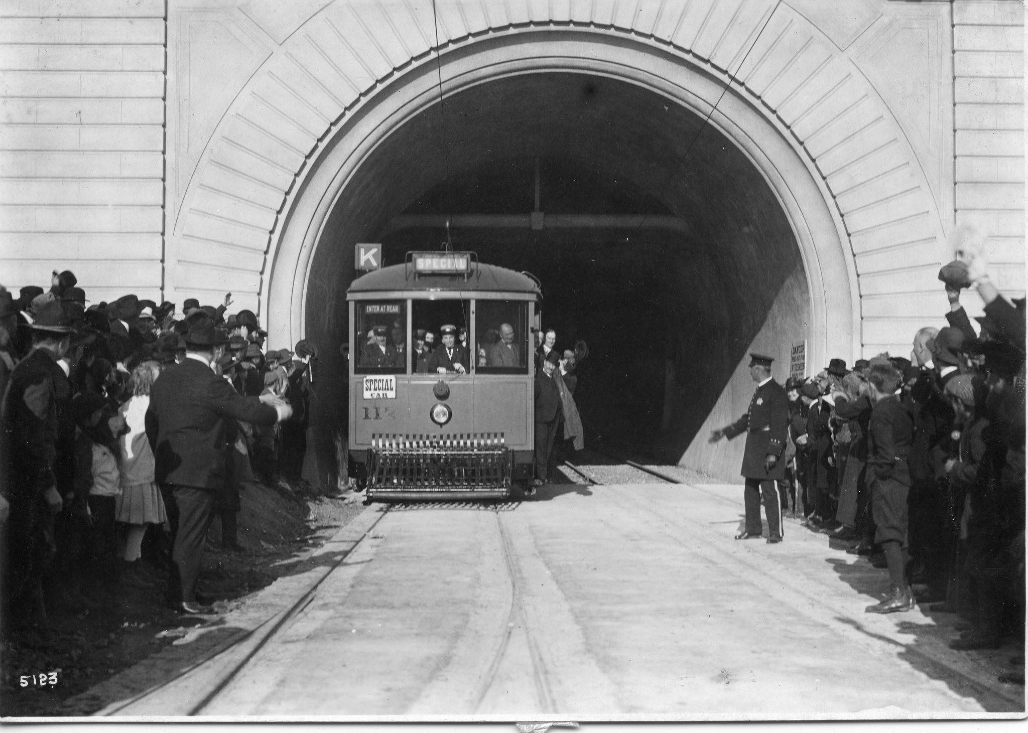
The Twin Peaks Tunnel opened for service February 3, 1918, with Mayor Rolph personally piloting the first Muni streetcar, No. 117, all the way through. A huge crowd turned out. The first line to serve it, the K-Ingleside, originally ran just a few blocks from West Portal to St. Francis Circle until an agreement was reached with United Railroads to share that company’s trackage on Junipero Serra Boulevard and Ocean Avenue.
The following year, the L-Taraval line opened as a shuttle from West Portal to 33rd Avenue. It reached Ocean Beach by 1923 and fostered growth for blocks in each direction through what became known as the Parkside neighborhood.
In 1925, another shuttle, the M-Ocean View, opened from West Portal to Broad and Plymouth Streets, running through open country in a narrow right-of-way bounded by empty residential lots, then following the alignment of 19th Avenue before turning east.
These same three lines run through the tunnel today, transitioning underground to the Market Street subway under Castro Street, but oh, how their surroundings have changed, especially the M’s.
While new homes sprang up along the routes of the K and L in a steady progression, the M saw much higher density growth – but not for decades. In fact, the M was so poorly patronized that streetcar service was suspended for five years starting in 1939.
The end of World War II brought many returning soldiers and sailors home to San Francisco and attracted many more who had passed through on their way to and from the war and liked the city they saw. The GI Bill gave benefits to these veterans including help buying homes and attending college. San Francisco State College mushroomed in size, growing a large campus on empty land along 19th Avenue at Holloway. Just south, a massive apartment complex named Parkmerced sprang up, and to the north, the City’s first large suburban-style shopping center, named Stonestown. The M-line served all these developments, and ridership steadily grew.
Coulda, Shoulda
There have been thoughts about altering or extending the Twin Peaks Tunnel several times, going back to the earliest planning stages, when one proposal called for a branch heading northwest from a point between the Eureka Valley and Forest Hill stations, to serve the central Sunset District, perhaps along Noriega Street. The Sunset Tunnel, completed farther north under Buena Vista Park in 1928, addressed this need instead, with the N-Judah line.
A later proposal came much closer to reality. The 1962 BART bound issue included money to extend the Twin Peaks Tunnel under West Portal Avenue to St. Francis Circle. When building the tunnel, the City could have made West Portal Avenue as wide as it wanted, since there was nothing but sand where the tunnel daylighted. As the shopping district developed outside the tunnel’s western entrance, drivers parking their automobiles slowed down the streetcars along the street. But the merchants on West Portal Avenue wanted that easy automobile access and opposed the disruption to their businesses the underground subway construction would pose. Muni ended up “trading in” the money set aside for a West Portal Avenue extension of the tunnel to help finance an additional Muni Metro/BART station at Embarcadero.
Second Century: More Important
If anything, the Twin Peaks Tunnel will become even more important in its second century. The connectivity provided by the M-line was a key factor in the city approving increased density for Parkmerced, where 5700 additional housing units are planned. Muni expects enough ridership growth there to be actively planning projects to speed up the M-line, including undergrounding the tracks under West Portal Avenue. The tab could reach $3 billion if all of the M-line from West Portal to Parkmerced were undergrounded. This, in turn, would allow a true subway-style operation of the M, with trains of up to four cars.
The passage of time has proven the value of the vision its boosters had for the Twin Peaks Tunnel.
We thank the wonderful SFMTA Archive for the use of most photos in this story, and we invite you to visit their great gallery of Twin Peaks Tunnel photos.
