When one thinks of San Francisco’s Sunset District, the image of fog, cold salty winds, and sand dunes comes to mind. People have aptly developed their perceptions of this part of San Francisco. While it might be sunny and warm in the Mission District, the Sunset often shivers under a blanket of fog with a biting wind off the ocean and a temperature fifteen degrees lower.
The Sunset, west of Twin Peaks and south of Golden Gate Park, is geographically the largest district in the City, and, with almost 90,000 residents, the most populous as well. It was also the last major chunk of town to be developed. That’s where Muni, its former competitors, and streetcars come into the picture.
Sand dunes and scrub
When people thought of San Francisco in its first 75 years of existence, they thought almost exclusively of the bustling port, downtown, and posh residential districts, all near San Francisco Bay. This made sense, as our unmatched natural harbor generated much of the city’s commerce. The city effectively turned its back on the mighty Pacific Ocean, so much so that the 11 square miles on the city’s oceanfront was known as the “Outside Lands”.
In 1870, inspired by New York’s then-new Central Park, the city engaged William Hammond Hall to design a similarly grand public open space cutting east to west across the Outside Lands. A street grid for the western part of town had been laid out, still mostly on paper, and the city claimed the four-block-wide swath of land between D Street (now Fulton Street) and H Street (now Lincoln Way) for the park, starting at Stanyan Street and running westward to the breakers of the Pacific. Residential neighborhoods were rising east of Stanyan, accelerated by the advent of direct-to-downtown cable car service on Haight, Hayes, and McAllister Streets. in 1883.
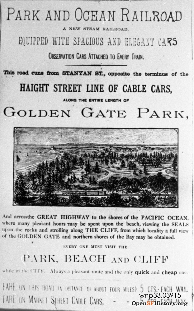
That same year, 1883, Southern Pacific interests, including Leland Stanford, effectively extended their Haight Street cable line westward by opening the Park and Ocean Railroad, using a steam train, from the Stanyan Street turntable to the doorstep of the already popular Cliff House. The steam line followed H Street/Lincoln Way almost to Ocean Beach, then turned north through the western edge of Golden Gate Park into the outer Richmond District, ending at B (Balboa) Street. The first weekend, 10,000 people reportedly rode that steam train to the beach. (San Francisco historian Gary Kamiya has a wonderful write up on the backstory of the Park & Ocean, linked here, but behind a paywall for some.)
From steam to electric
This steam route was electrified in 1898, and by 1902 was operated by conventional streetcars, though not really for residents — because there were hardly any. The northern end of Ocean Beach, where the Cliff House and Adolph Sutro’s grand bathing palace were located, were a prime Sunday recreation destination, soon attracting a fast growing amusement park called Chutes-at-the-Beach as well (renamed Playland in 1926). The Lincoln Way route to the beach was faster for San Franciscans from the Mission District and other working class neighborhoods south of Market and on Sundays, and United Railroads (which had consolidated several private companies in 1902) would add streetcars from other lines to the Haight/H Street line to handle the crowds.

Having the streetcar tracks right up against the park had a side benefit. The city contracted with United Railroads to carry ‘street sweepings’ (horse manure) to fill in sandy gullies in outer Golden Gate Park. The company had special work cars with tilting bins that did the deed, using temporary trestles built from into the swales in the park. So in a way, streetcars built the Sunset’s park before they built the Sunset itself.
Carville
The few residents in the Sunset early in the 20th century were concentrated near Ocean Beach and generally lived what was called a Bohemian lifestyle. They turned discarded horsecars and cable cars into beach cottages.
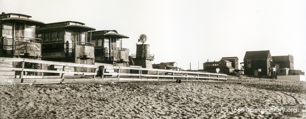

In his book Carville-by-the-Sea, San Francisco historian Woody LaBounty says the retired railcars were used as “residences, vacation homes, clubhouses, restaurants, and even churches.” Famous people, including Jack London and poet George Sterling, visited. Gradually homes were built around the railcars and they disappeared from view, but LaBounty says at least one, a shingled box on Great Highway, has “a unique living room created from two cable cars while the bedroom is an intact horsecar.”
Streetcar startup service

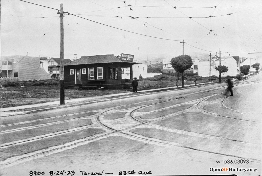
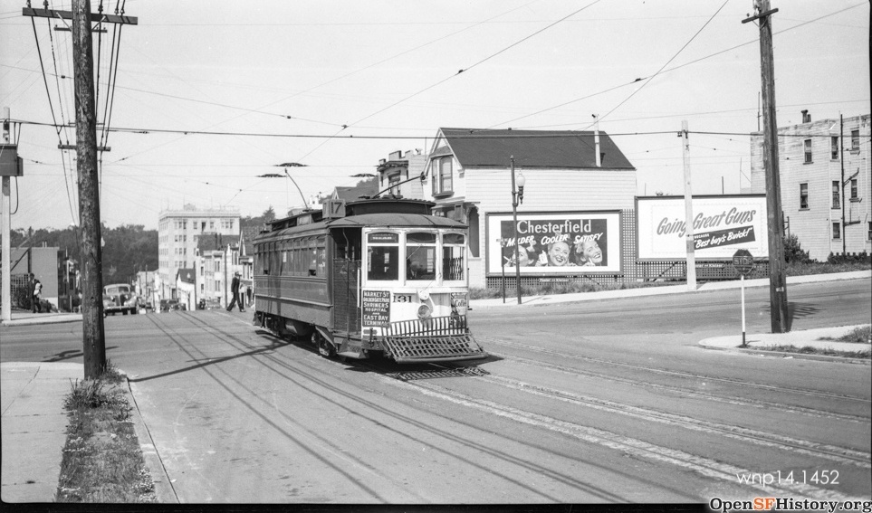
Carville residents used the Lincoln Way streetcars, which came to be numbered the 7-Haight line, but there wasn’t much else in the way of residents out west then. A developer subsidized a United Railroads (URR) subsidiary called Parkside Transit Company, running a line on 20th Avenue from Lincoln Way to Taraval Street, then west on Taraval to 33rd Avenue and south to Sloat.
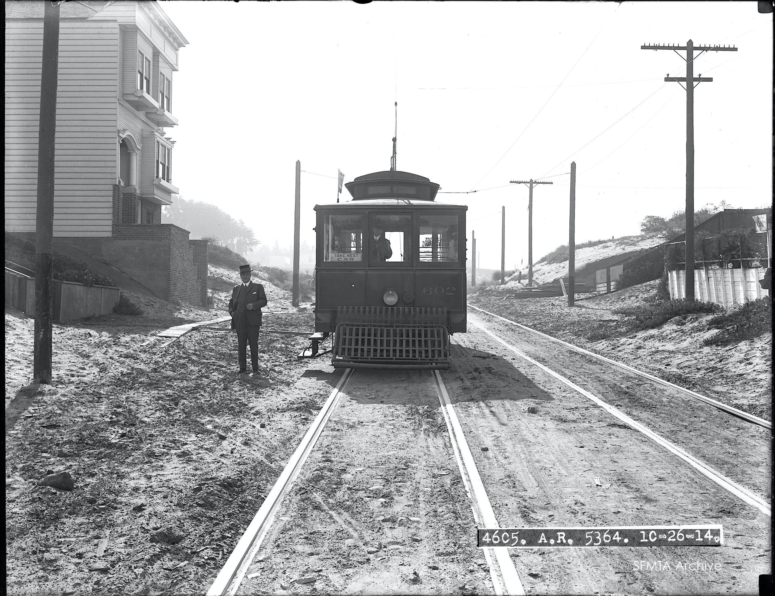
In 1916, URR used the Parkside Transit trackage to run a new line, the 17- Haight & Ingleside from the Ferry alongside the 7-Haight & Ocean line, then cutting across the Sunset on 20th almost all the way to Sloat, jogging over on Wawona to 19th Avenue (back then then a regular-width, sleepy street) to go around what became Stern Grove and reach Sloat. There, the 17-line met up with the 12-Mission & Ingleside line that came down Mission Street from the Ferries, then across Ocean Avenue. The 12 then ran in the middle of extra-wise Sloat Boulevard to the Beach. But for decades, these lines traversed what were truly the “Outside Lands”, with few houses to serve at and no ‘built-in’ attractions like the beach amusements in the Richmond District (the Zoo and Fleishhacker Pool at Ocean Beach and Sloat) didn’t open until the 1930s).
The 12 and 17 lines were roundabout routes because Twin Peaks, Mt. Davidson, and Mt. Sutro separated the Sunset from the developed part of town. Coming in from Haight or Mission Streets was a slow ride and did not do much to attract people to live under the blanket of gray.
Muni burrows its way in

Enter the Municipal Railway, the City-owned streetcar system opened in 1912 on Geary Street. Real estate developers saw a potential gold mine in the Sunset, and encouraged politicians to extend fast Muni service to the district by means of tunnels and agreed to assess themselves to pay for it.
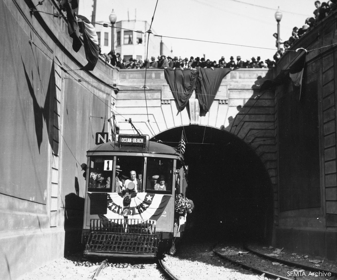
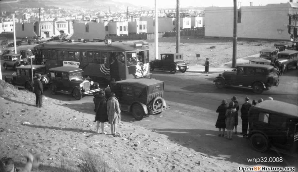
For ‘can-do’ City Engineer M.M. O’Shaughnessy, that encouragement fit right in with his own vision. In 18 months, he holed through one of the longest streetcar tunnels ever built, from Castro and Market under Twin Peaks to the middle of nowhere. When it opened on Feb. 3, 1918, with Mayor ‘Sunny Jim’ Rolph at the controls of gray-and-maroon car No. 117, 10,000 turned out to cheer. Here’s a comprehensive look at how the Twin Peaks Tunnel came to be.
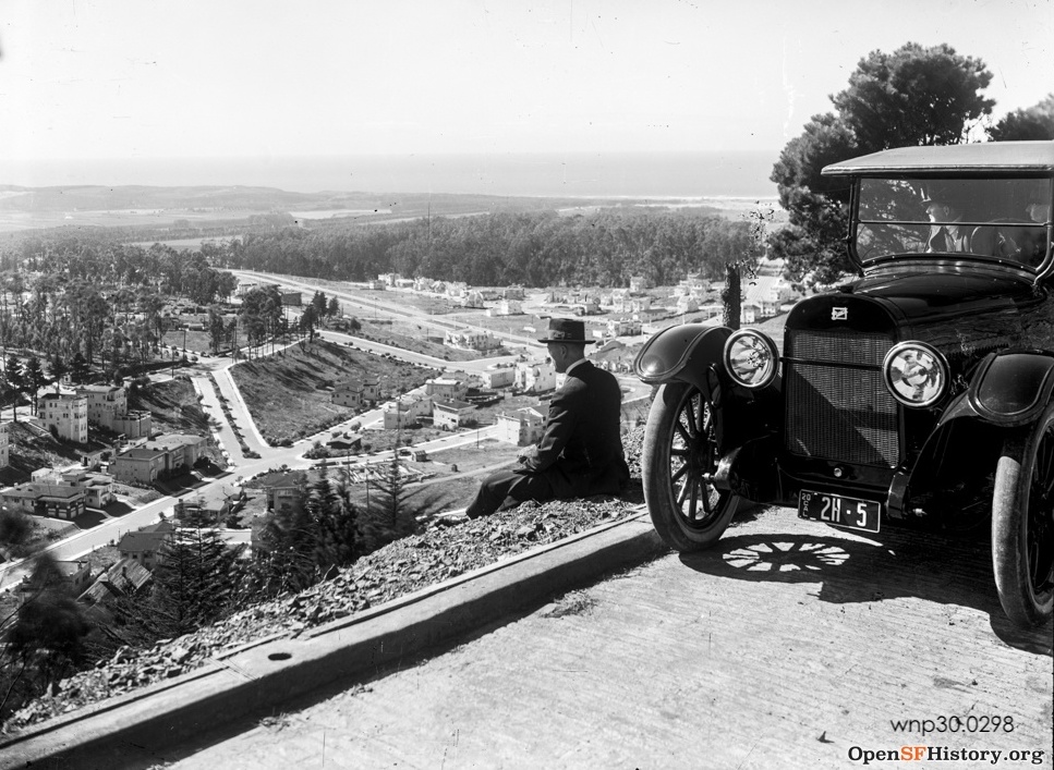
New upscale neighborhoods soon appeared because of the fast tunnel service to the downtown business center. Forest Hill spread out around the station in the middle of the tunnel; indeed, real estate developers helped pay for the tunnel. Just beyond and south of the tunnel’s West Portal, the ritzy St. Francis Wood grew up.
But here, we concentrate on the development of the expansive sand dunes that formed the flat part of the Sunset District. So we won’t discuss two of the three lines that Muni established through the Twin Peaks Tunnel: the K-Ingleside, which shared tracks with URR’s 12-line on Junipero Serra and Ocean Avenue, and the M-Ocean View, which ran through sparsely settled land southeast of the tunnel, but later grew important with the development of Parkmerced, Stonestown, and San Francisco State University.
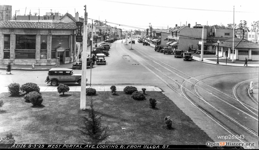
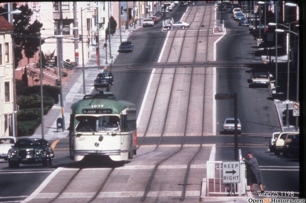
The Twin Peaks Tunnel line that made the big difference in developing the southern Sunset District (which many call the Parkside District, though its nowhere near Golden Gate Park) was the L-Taraval, which opened in 1919 as a shuttle from West Portal and was extended through the tunnel in 1923. The L was originally planned for Vicente Street, but instead shared the tracks of the URR’s Parkside line from 20th Avenue to 33rd Avenue. See our centennial celebration of the L-line here for more detail on the L.
Sunset Tunnel
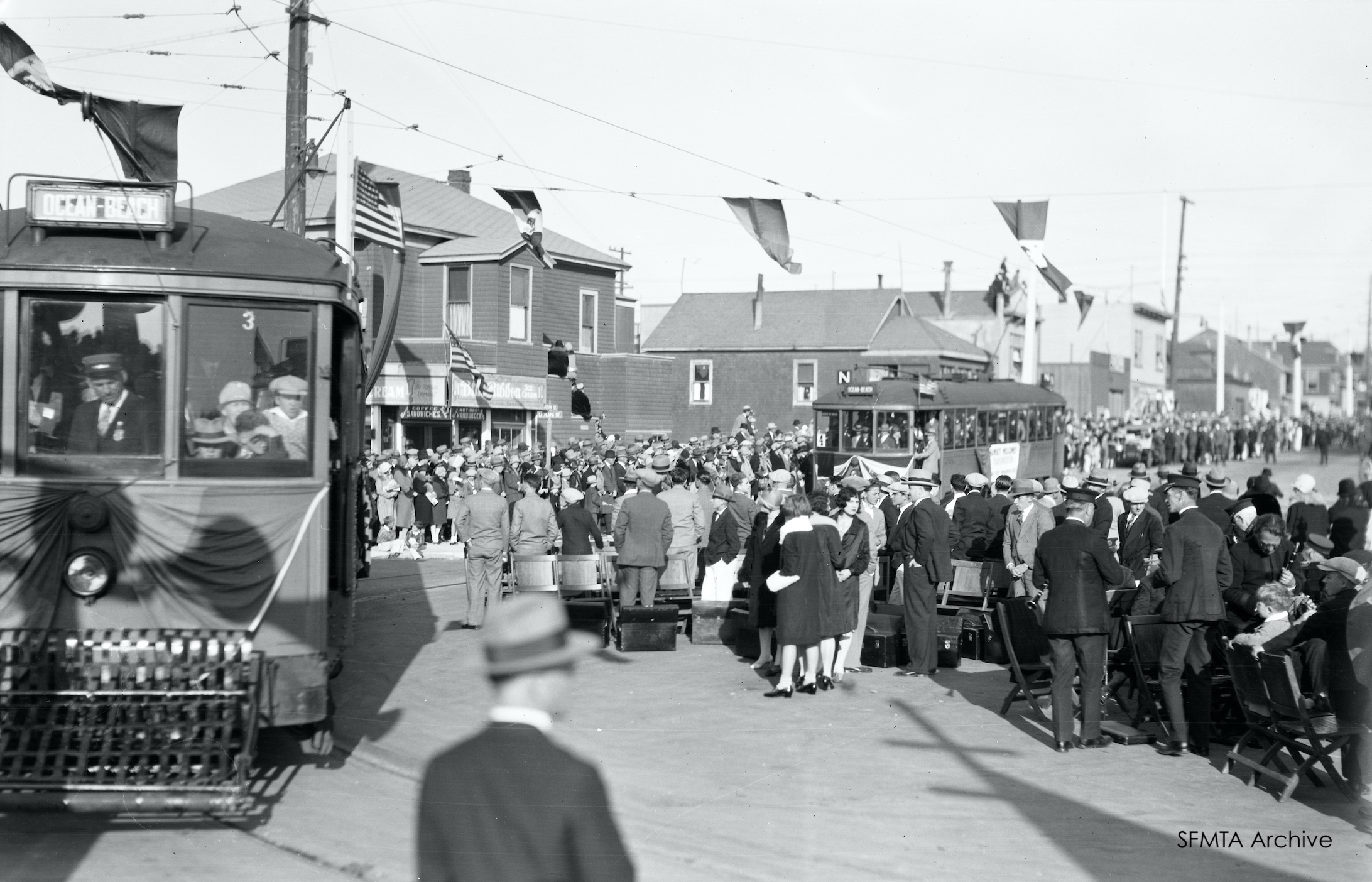
Ten years after Twin Peaks, Muni tunneled again, this time under Buena Vista Park to create the N-Judah line from the Ferry Loop to a loop at Ocean Beach. The N made the parallel MSRy 7-line on Lincoln Way seem poky, what with all its stops on Haight while the N zipped through the tunnel.
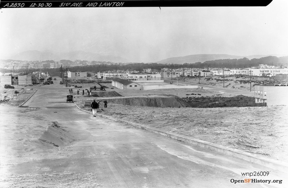
The L, and N, running parallel ten blocks apart through the Sunset, facilitated a building boom in the 1930s, further fueled by low-interest Federal Housing Administration (FHA) loans. Developers such as Henry Doelger and Standard Building Company (“Sunstream Homes”) came to dominate the district, focused on working-class families.
Consolidating Sunset service
Expansion of Muni to the Sunset was a deliberate act of public policy. The investment in tunnels was made knowing Muni’s private competitor couldn’t afford to match it, and would lose competitive advantage. The City wanted that: its goal was to municipalize–take over–all transit services, which it did by buying out the old Market Street Railway Co. in 1944 and the Cal Cable Railway Co. in 1952.
Lack of money blunted Muni’s expansionist fervor, though. After the takeover of Market Street Railway in 1944, Muni could have rebuilt the worn-out track of MSRy’s 7, 12, and 17 lines and routed them through the Muni tunnels to speed those lines’ riders downtown. But voters had only funded purchase of the MSRy’s decrepit assets Instead, Muni ripped out the tracks and either discontinued parts of the routes or put buses on. Nor did Muni leverage its tunnel investment by adding additional lines on streets built extra wide to accommodate transit, such as Noriega.
Buses make their mark
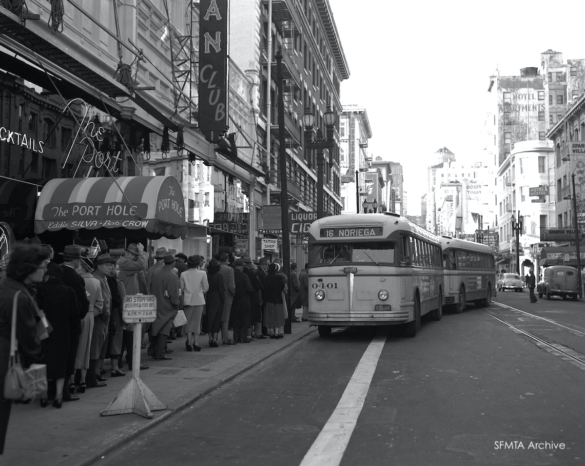
However, Muni did take advantage of wide Sunset streets for bus service. Muni opened a pioneering bus on Noriega Street in 1941 that connected to the N at 22/23 Avenues and Judah. (This was extended downtown at the end of the 1940s to become the 71-Haight-Noriega with rush-hour extra service on the 16x-Noriega Express.) Another Haight Street bus, the 72-Haight-Sunset, ran down Sunset Boulevard (built in the 1930s as an automobile thoroughfare between 36th and 37th Streets) to Sloat. And after 19th Avenue was widened in 1937 to carry Highway 1 between the Peninsula and the Golden Gate Bridge (which forced the cutback of the southern terminal of the 17-line streetcar), Muni established its 28-line in 1949, still one of its most important crosstown lines, now running from Fort Mason to the Golden Gate Bridge and then all the way south to the Daly City BART Station.
Real estate was so cheap in the Sunset back in the day that Muni’s private competitor bought two entire blocks to serve its streetcar operation (even though it had few lines out there). It owned the block bounded by Lincoln Way and Irving Street, Funston and 14th Avenues, originally intending to build a massive car barn there. Tight finances led them to turn it into a “boneyard” for out of service cars. 
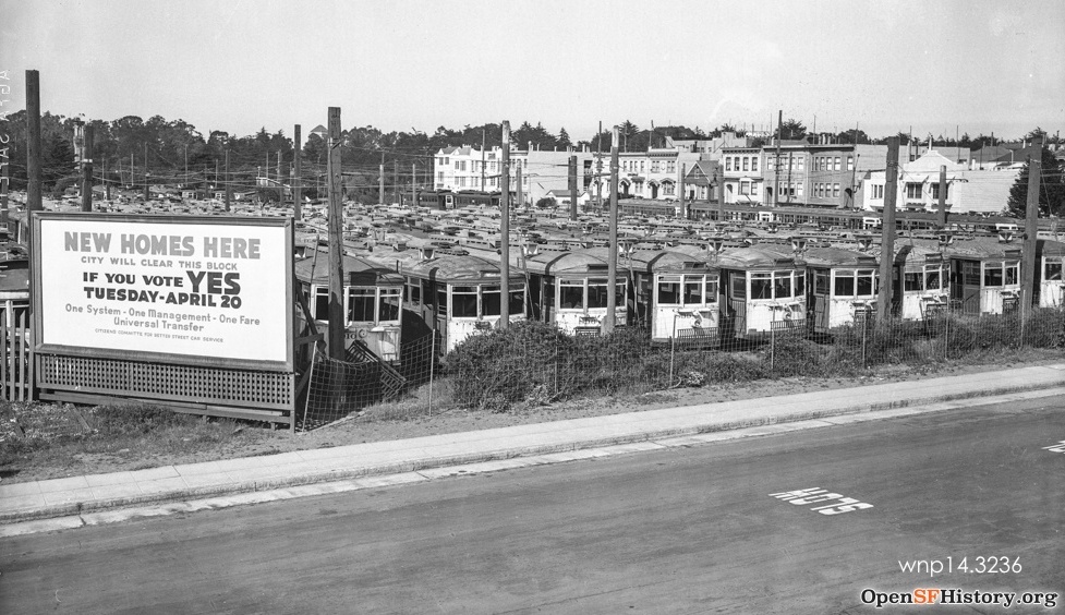 The 1943 photo above shows a billboard at the boneyard promising to sell the land for housing if voters would approve purchase of Market Street Railway. (They finally did, the following year.) Of lesser value, but still important to Market Street Railway operations, was the block bounded by Pacheco, Ortega, and 21st and 22nd Avenues. The sand dunes there were “mined” by a conveyor belt on rails and loaded onto a differential dump car, which accessed the lot via a spur on Pacheco Street from the 17-line, delivering the sand to streetcar barns for use in helping stop streetcars when tracks were wet.
 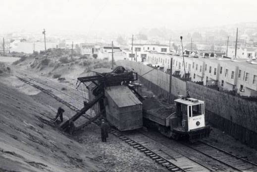 This shot was taken in the late 1930s, after MSRy had already sold the strip at the right of the photo along 21st Avenue for new houses.
Other Muni bus lines connecting the streetcar trunk lines included the 18-Sloat, which took over the outer 12-line when streetcars were abandoned there after World War II and then crossed the Sunset on 46th Avenue, and the 66-Quintara, a lightly ridden route that serves now as a feeder for the N, but formerly ran rush hour service downtown via Haight Street. Today, Quintara is mainly served by the 48-line, another “Bay to Breakers” route that runs from Third Street in Dogpatch over 24th Street, Portola Drive, West Portal, and Quintara, with the distinction of connecting all six Muni light rail lines. In the past decade, heavy demand on the N-line led Muni to add peak hour express bus service to the N between Ocean Beach and Downtown.
But for the narrowness of the Twin Peaks Tunnel and (to a lesser extent) the Sunset Tunnel, the K, L, M, and N streetcar lines might have been converted to buses too, instead of being put into the Market Street Subway in the 1980s with modern light rail vehicles. By the 1950s, transit managers around America were bus-crazy, and operating costs of Muni’s old style streetcars, which required two operators by city ordinance, led Muni to cut streetcar service way back, even substituting a bus line called the 48- Ingleside-Taraval for K and L streetcars nights and Sundays in the early 1950s.
Muni Metro era
Fortunately, though, voters repealed the two-operator requirement for modern streetcars in 1954, enabling Muni to replace its original streetcar fleet by 1958 with the streamlined “PCC” (like the F-line’s colorful daily fleet). The 1962 passage of the BART bond issue included a new subway under Market for Muni. To complement it, Muni planned major upgrades on its streetcar lines in the Sunset for faster operation. The deteriorating N-Judah trackway was rebuilt as a raised right-of-way in the mid-1970s, but opposition from residents over more difficult access to their driveways kept the trackway from being extended to the beach or from being implemented on the L-line. Fitfully and over significant resident opposition, Muni has been able to make incremental operating improvements on the N and L lines since then.
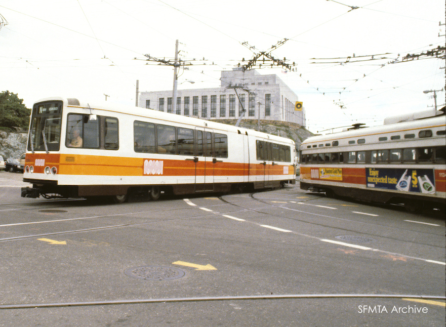
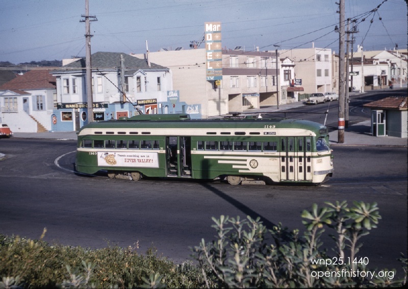
The PCCs gave way to shiny new Boeing-Vertol light rail vehicles as the J, K, L, M, and N lines migrated into the new Market Street subway by 1982.
Remnants of streetcars past
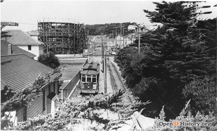
Today, by looking carefully, one can catch glimpses of the early transit investment that spurred the Sunset to life: the spur of the L-line on Taraval from 46th to the Beach, now the oldest (1923) surviving streetcar trackage in town; the wide median running the length of Sloat, put there to carry the old 12-line; and Railroad Trail behind the Beach Chalet in Golden Gate Park, the route of the old steam trains, and later the 7-line streetcars, discontinued through the park in 1947. All part of the legacy of streetcars in the Sunset.
Written by Rick Laubscher. Thanks to the Western Neighborhoods Project and SFMTA Archive for use of their photos. Uncredited photos are from the Market Street Railway Archive.
